City routes, live traffic, transit routes, parking, offline map, and navigation—2GIS has got you covered. We've updated 2GIS to enhance your experience, as it has become challenging to showcase everything we've discovered about cities and companies within the old app structure. The new version of 2GIS boasts a fresh design, an improved search function, better city updates, and a seamless integration of favorites with 2gis.ru.
Services, Addresses, and Companies
2GIS is your go-to source for finding out which service provider operates in your building, locating your nearest district hospital or post office. It helps you select cafes or service centers based on reviews and photos, and provides essential details like opening hours and contact numbers.
Transport and Navigation
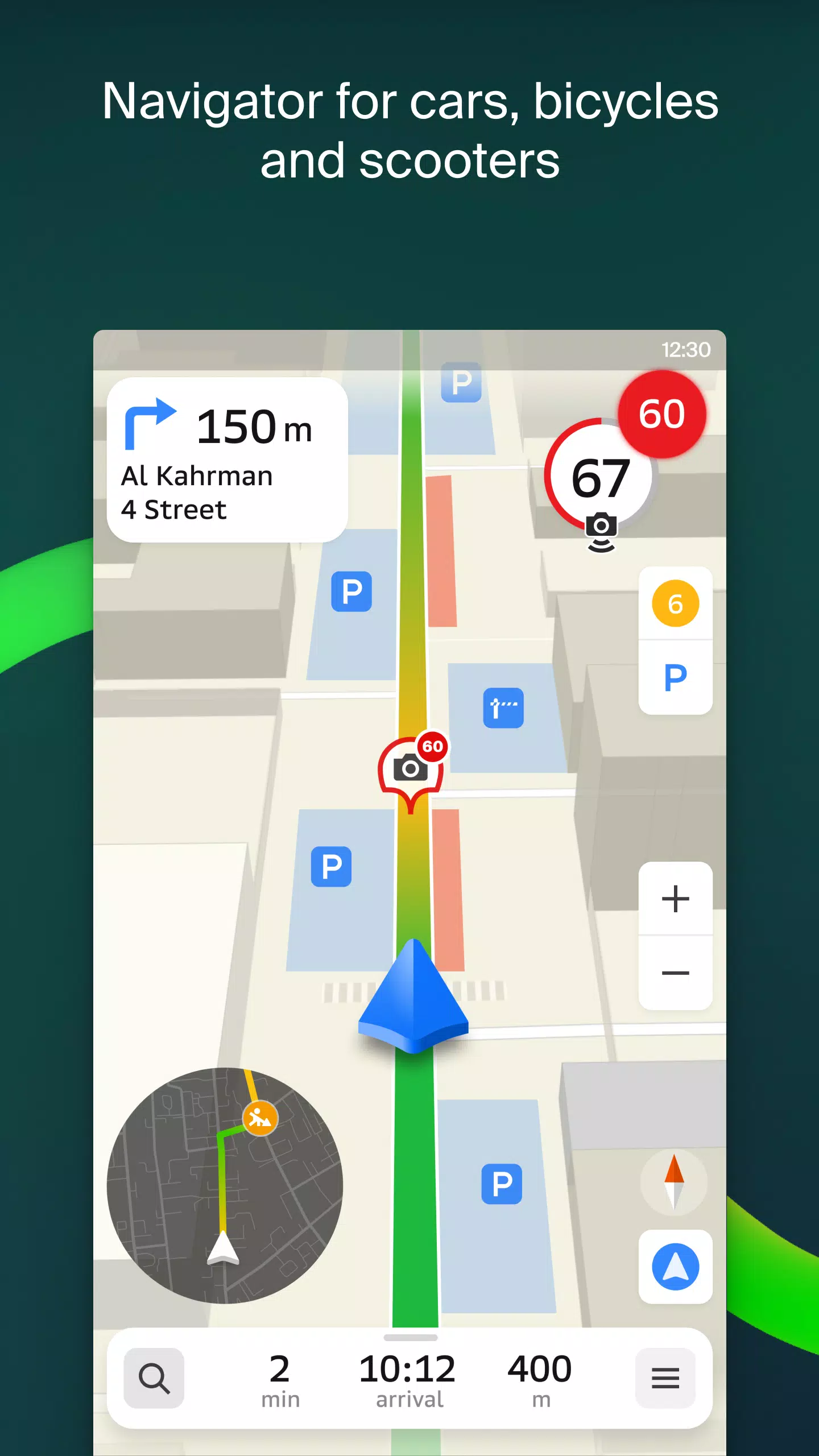
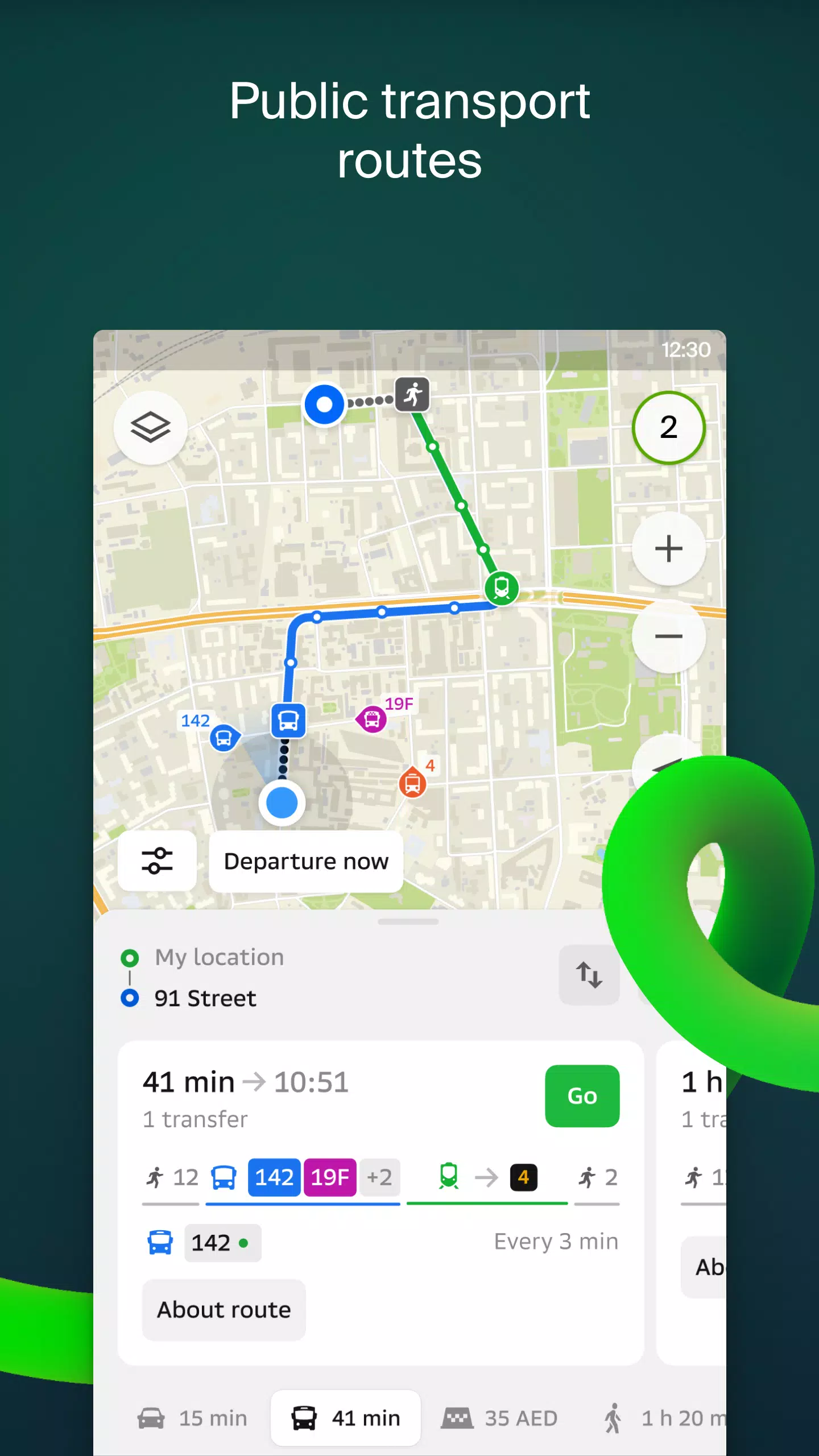
For drivers, 2GIS offers reliable route guidance with voice instructions, taking into account traffic congestion and road closures. If you stray from your planned route, the app will recalculate your path in real-time. For those on foot, 2GIS offers transit options including buses, metro, trains, cable cars, and river trams.
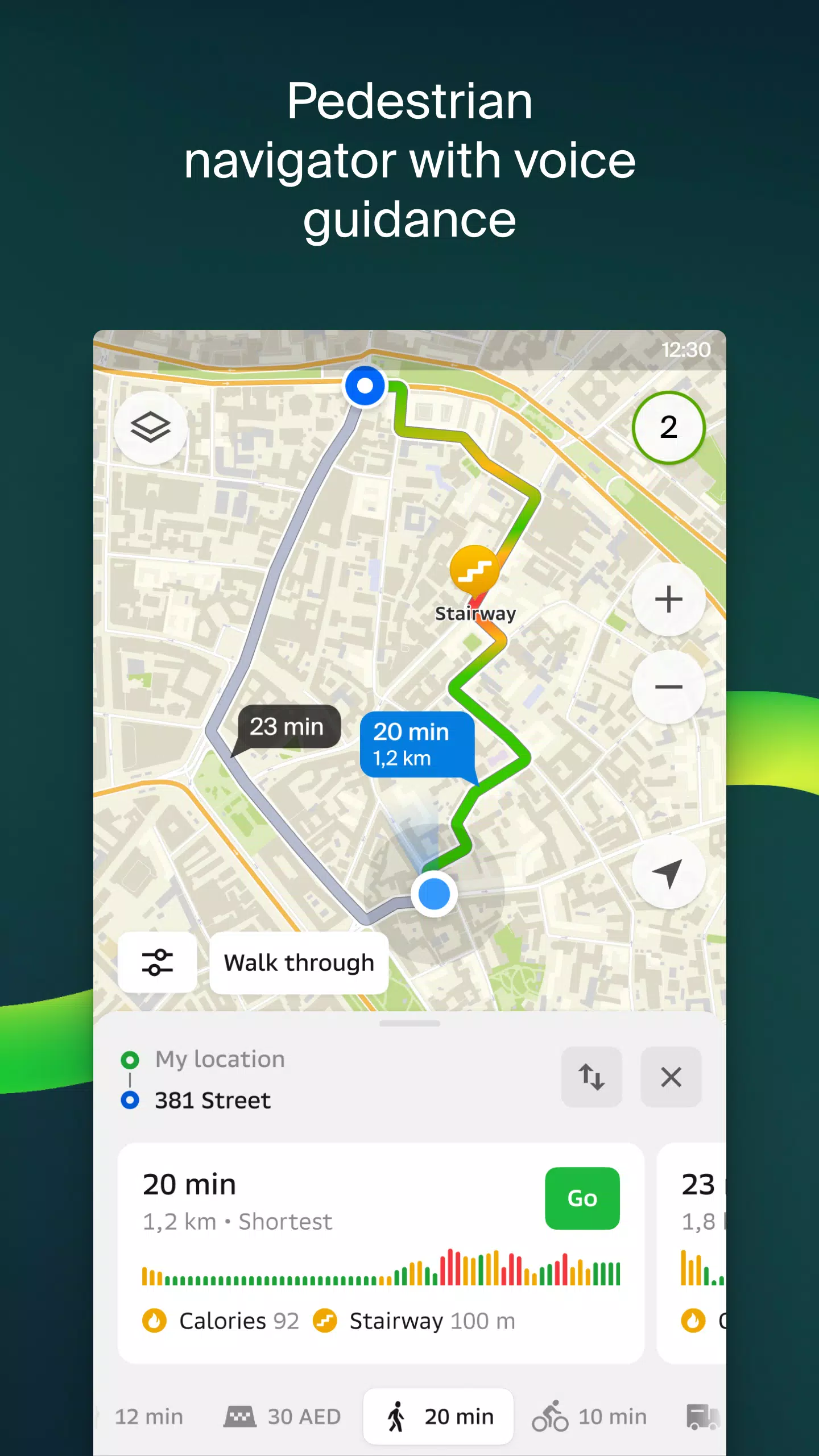
Walking Routes
Pedestrian navigation in 2GIS charts out walkable paths and operates smoothly in the background, complete with voice guidance.
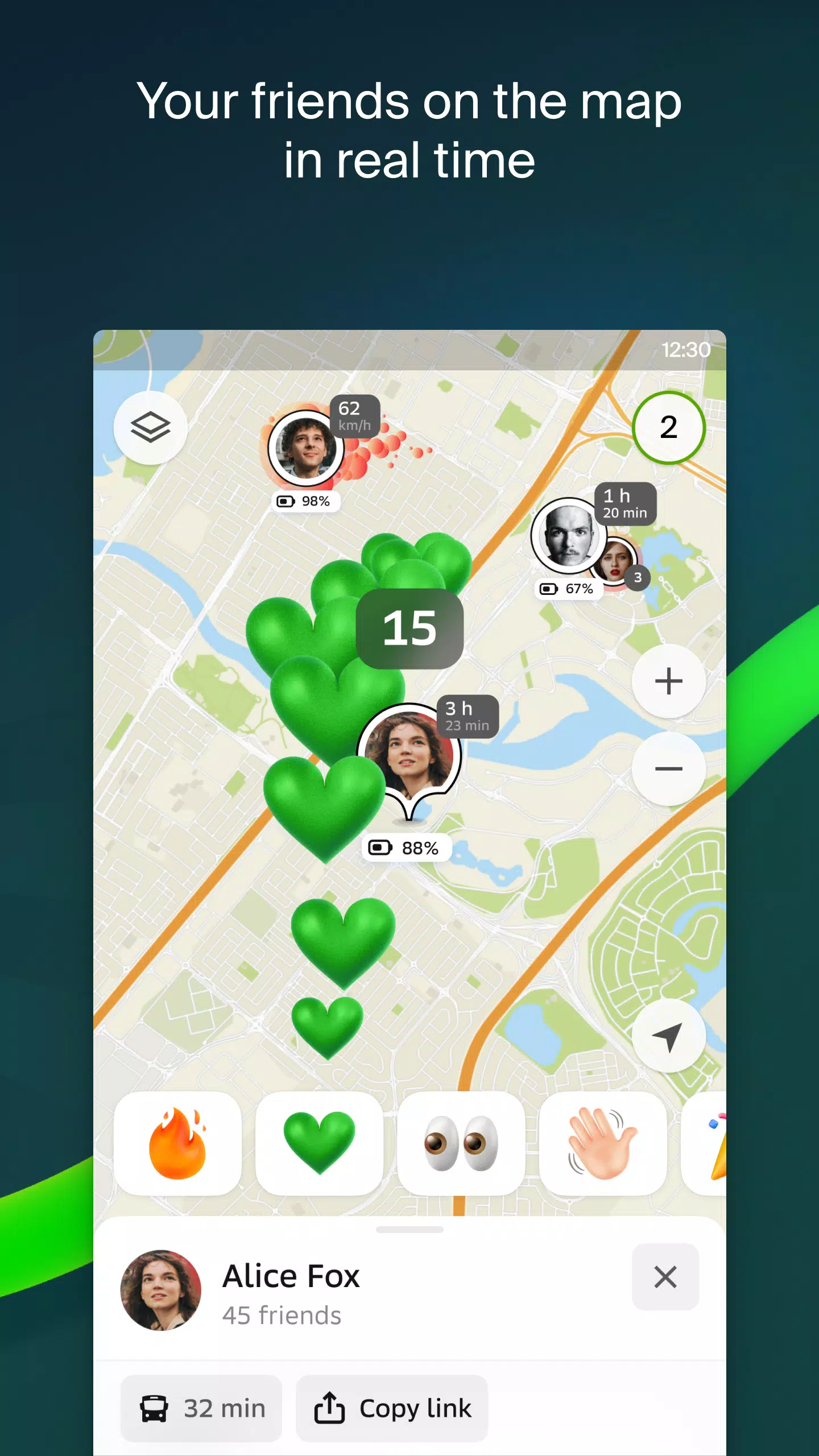
Friends on the Map
Stay connected with loved ones as 2GIS allows you to see your friends' and children's real-time locations on the map. You control your privacy settings, deciding who can see your location and who you want to connect with.
Building Entrances
No more wandering around to find the entrance to a business center. 2GIS knows the way into 2.5 million companies and will guide you right to their doorstep, whether you're driving or using public transport.
Plans of Shopping Centers
Navigate shopping centers with ease using 2GIS. From shops and cafes to ATMs and restrooms, the app helps you plan your visit in advance, saving you time.
2GIS Beta Notifications Companion App
For Wear OS smartwatches, the 2GIS beta Notifications companion app is a handy tool for navigating routes on foot, by bike, or public transport. View maps, get maneuver hints, and receive vibration alerts as you approach turns or bus stops. The app auto-starts when you begin navigation on your phone and is compatible with Wear OS 3.0 or later.
As a beta tester, you'll receive the latest updates as we fix bugs and errors, contributing to the development of a new version of 2GIS that will be used by millions. You can run both the original and beta versions simultaneously, switching between them as needed.
Support: [email protected]
What's New in the Latest Version 6.44.1.559.3
Last updated on Oct 19, 2024
We're excited to bring you beautiful, crisp updates in the latest version of 2GIS:
- We now display wide, realistic roads on the main map and when searching for routes.
- Introducing Chats for Friends! Message each other without leaving the map.
- Added notifications when a friend is nearby (which you can turn off in settings).
- Just in time for ski season: we've added ski lift statuses on slopes to help you plan your day.
- For public transport routes that include walking, we now calculate the walking part in steps for better accuracy.
6.44.1.559.3
179.3 MB
Android 6.0+
ru.dublgis.dgismobile4preview