
Application Description:
OfflineMaps: Your All-in-One Offline Map Solution
OfflineMaps provides extensive map access, completely free from ads, data sharing, analytics, and third-party libraries. Tired of waiting for maps to load? OfflineMaps ensures quick access to maps, even without an internet connection. Once downloaded, maps are readily available.
Key Features:
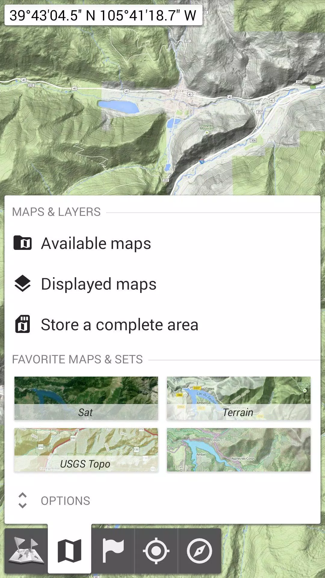
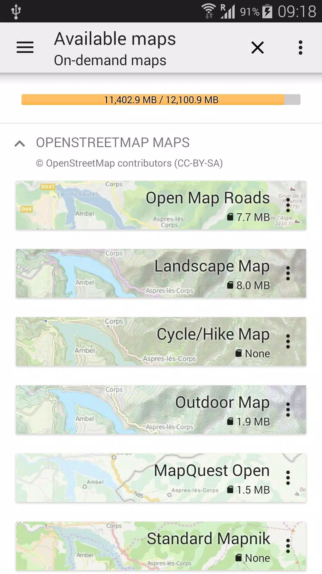
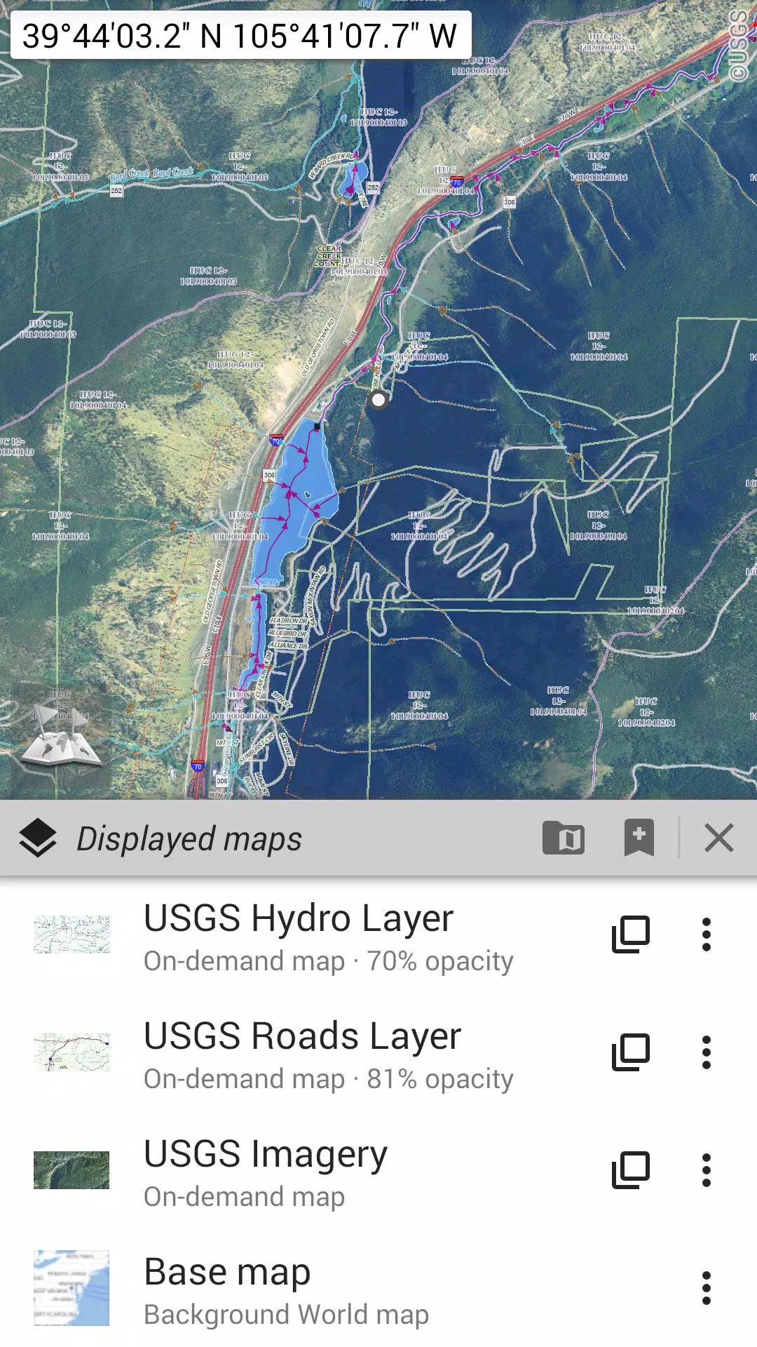
- Beyond Basic Road Maps: Access a variety of map types including road maps, topographic maps, aerial (satellite) imagery, and customizable layers. Options include OpenStreetMap (Roads, Topo), USGS National Map (high-resolution topo, aerial imagery), and worldwide military Soviet topo maps.
- Reliable Offline Access: Perfect for areas with poor or no network coverage, international travel, or users with limited data plans.
- Layer Control and Management: Stack maps in layers with precise opacity control. Easily select and store large areas, and manage your stored map data efficiently.
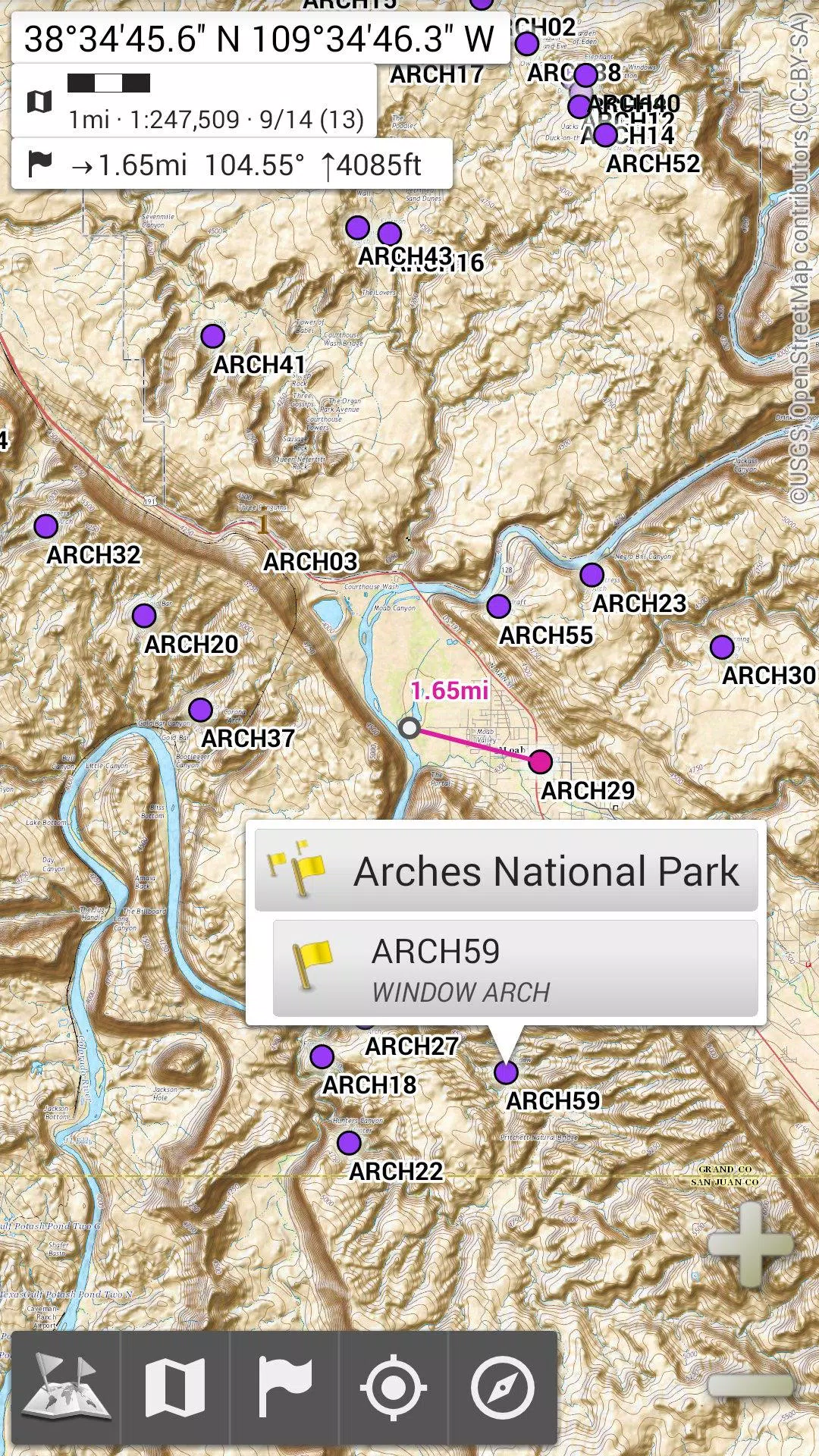
- Unlimited Placemarks: Add and manage waypoints, icons, routes, areas, and tracks directly on the map using the powerful SD-Card Placemarks Explorer.
- Integrated GPS: View your real-time location and orientation on the map. Rotate the map to match your direction (device capabilities permitting). Easily toggle GPS on/off to conserve battery life.
- Customizable Units and Coordinates: Choose from metric, imperial, and hybrid distance units. Support for various coordinate formats, including UTM, MGRS, USNG, and many more. Import hundreds of coordinate formats from https://www.spatialreference.org.
- Additional Features: On-map grids, full-screen map view, multi-touch zoom, and more.
Looking for Advanced Features?
For serious adventurers, explore AlpineQuest Off-Road Explorer, a comprehensive outdoor navigation app built on the OfflineMaps platform. It includes a powerful GPS track recorder and many more features: https://www.alpinequest.net/google-play
Screenshot
App Information
Version:
3.15d
Size:
7.2 MB
OS:
Android 2.1+
Developer:
Psyberia
Package Name
net.psyberia.offlinemaps
Available on
Google Pay
Reviews
Post Comments


Trending apps


Software Ranking